Forest road sector · White Mountains · ·
Saco Ranger Station Loop
Most of this loop is a walk through a forest that burned in 1907 and regrew as a nearly pure stand of paper birch, which in winter means a white-on-white landscape that is genuinely hard to read. The route uses two snowmobile corridors and one section of the old Swift River Railroad grade, and it is the only route in this guide where the navigation challenge comes from a lack of visual contrast rather than a lack of signs.
Arrival
From the Kancamagus Highway at the Saco Ranger Station. The loop leaves from the north side of the lot on a snowmobile corridor for 1.2 km, then turns west onto the railroad grade. Both brook crossings - at 3.4 km and 6.1 km - are on timber bridges that are plowed by the snowmobile club. There is no fee and the ranger station is open 08:00-16:00 in winter.
The line
0.0-1.2 km · Snowmobile corridor
Shared with machines, wide and fast. Stay to the right-hand edge and expect them to pass at speed. This is the only part of the loop where you will see other people on a weekday.
1.2-3.4 km · Railroad grade climb
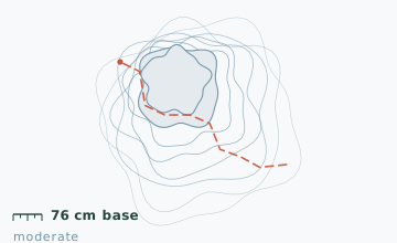
The 1907 burn regrew as paper birch on a shallow 6-degree grade. There are no landmarks: every tree is the same height and the same colour, and the trail surface is white on white. Snow depth at the 2.6 km stake measured 76 cm on 11 February.
3.4-6.1 km · Ridge and second crossing
The grade tops out at 380 m and passes a clearing with three cellar holes from a farm abandoned in 1938. The second brook crossing at 6.1 km has a bridge that is 1.2 m above the water and is plowed.
6.1-8.8 km · Return along the brook
The route follows the brook south-east on a broad, flat corridor back to the ranger station. The last 1.2 km is the same snowmobile corridor you started on, approached from the other direction.
Travelling the line, step by step
- Walk the loop clockwiseThis puts the brook on your left for the entire return leg, which is the only reliable handrail in the birch stand.
- Note your compass bearing at the 1.2 km turnThe turn off the snowmobile corridor onto the railroad grade is easy to miss on the return. Take a bearing and note the time.
- Stay on the right edge of the snowmobile corridorMachines come through at 60 km/h or more. Keep a bright item on the back of your pack and do not stop in the middle of the corridor to adjust anything.
- Use the cellar holes at 4.9 km as a confirmation pointThree rectangular depressions in a clearing are the only unambiguous landmark on the whole loop, and they confirm you are on the right line.
What to carry
- Snowshoes - the birch stand off the snowmobile corridor is not packed
- Compass and map, or a GPS track; this is the route in the guide where people most often walk the wrong way in flat light
- One pole
- A bright item on your pack for the snowmobile corridor section
- Insulated bottle and food; there is no shelter and no open water except at the two bridged crossings
- Sunglasses - the all-white birch stand is unusually hard on the eyes in any sun
What can go wrong
- IceThe 1907 burn section holds a rain crust for weeks after a thaw because it is flat and shaded.
- Open waterBoth brook crossings are bridged, but the approaches on the north side ice over and are the usual fall spots.
The real hazard on this loop is navigation in the birch stand, where the only reliable cues are your compass and the sound of the brook. Walk the loop clockwise so the brook is on your left for the return leg. Snowmobiles use the corridor at high speed and cannot stop quickly, so keep right and keep a bright item visible. The ranger station can give you a printed route card at the desk.
Before you go
- Why is the birch stand so uniform?
- The 1907 fire burned hot enough to kill the seed source for conifers in the core of the burn, so paper birch and pin cherry came back almost alone. Birch is short-lived, which is why the whole stand is the same age and height.
- Do I need a pass for the Kancamagus corridor?
- Not in winter. The fee is charged at the highway's recreation sites from May to October only.
- Can this be shortened?
- Yes, by turning around at the first brook crossing. That makes it 6.8 km and keeps the whole route on the railroad grade.
Nearby and similar
- Bear Notch West Side Road · White Mountains · 11.2 km · Easy
- Tuckerman Ravine Base Line · White Mountains · 7.6 km · Challenging
- Lost Pond Trail · White Mountains · 3.4 km · Moderate
The figures above are our own measurements from the date shown. Only the conditions on your day count: check the current forecast, the gate bulletin and the snowpack before you set out, and treat every ice crossing as open until you have tested it.