Mountain sector · Laurentides · ·
Mont Condor Lookout Route
Mont Condor is what the Centennial would be if you cut the exposure and halved the distance. Two crests, one real lookout platform at 720 m, and a snowpack that stays deep because the ridge is broad enough to catch snow rather than strip it. It is the route most local people use to train for bigger days, which means the track is usually broken within 48 hours of a storm.
Arrival
From Route 117 take Chemin du Mont-Condor west; the road climbs for 2.4 km on a grade that is plowed but not sanded past the first kilometre. The C4 pad is on the left immediately after the second switchback. Snowshoes can stay on your pack for the first 800 m, which is a hard-packed access track used by the two cabins at the base.
The line
0.0-0.8 km · Access track
Flat and hard-packed. Two cabins on the right are private; the route passes 30 m behind them on a marked corridor. This is the section where most people realise they left the snowshoe straps in the car.
0.8-3.1 km · Forest climb to the lower crest
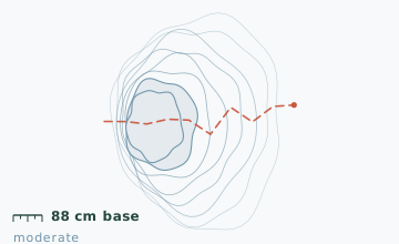
A steady 18-degree climb through sugar maple and yellow birch. The grade is even enough to walk without switchbacks until the 2.4 km mark, where a short 25-degree pitch leads to the lower crest. Snow was 88 cm on the stake at 2.1 km in early February.
3.1-4.4 km · Ridge to the lookout
Broad, gently undulating ridge with good snow cover the whole way. The lookout platform sits at 720 m on the second top; a steel stairway of 22 steps gets you onto the deck itself.
4.4-6.2 km · Descending the north side
The north descent is steeper and holds softer snow, so expect to sink 20-25 cm even on a broken track. It rejoins the access track 500 m above the parking.
Travelling the line, step by step
- Start on the access track with snowshoes on the packThe first 800 m is packed hard by cabin traffic. Carrying rather than wearing saves about 10 minutes and a lot of ankle roll.
- Switch to snowshoes at the corridor markerThere is a small wooden post where the corridor leaves the cabin road. This is the point where the surface goes from packed to 40 cm of loose snow.
- Take the lookout stairway one step at a time, hands freePoles go in the pack or get carried in one hand. The shaded side of the stairway is glazed from December to March.
- Descend the north side rather than reversing the climbThe north descent is 0.6 km longer but avoids meeting uphill traffic on the 25-degree pitch, which is where nearly all collisions on this route happen.
What to carry
- Snowshoes - the north descent needs flotation even on a tracked route
- One pole is enough here; two if you have knee trouble on descents
- Gaiters that actually seal over the boot cuff
- Insulated flask plus a small snack; the lookout is a good 20-minute stop
- Sunglasses - the ridge is open and south-facing
- Trail map (the corridor behind the cabins is not signed in English)
What can go wrong
- IceThe 22-step lookout stairway ices over on the shaded side and is the single most common place for a fall on this route.
- Open waterA small brook crosses at 5.1 km on the north descent; it stays open in mild spells.
This is a low-consequence route with two exceptions: the lookout stairway and the 25-degree pitch at 2.4 km. Both are short. Cell coverage is reliable to about 5 km, so a late start is recoverable. The cabin owners ask that groups keep quiet within 100 m of the buildings, and the corridor is closed to snowmobiles, which is why the track stays clean.
Before you go
- Is the lookout platform open in winter?
- Yes, it is not gated. The stairway is cleared once a week by a volunteer group, usually on Thursdays, so Friday and Saturday have the best footing.
- Can I link this to the Centennial?
- A connecting ridge line exists but it is not marked and adds 6 km of off-track travel with one steep drop. It should be treated as a separate, harder objective.
- How deep is the snow really?
- The 88 cm figure is the base stake at 2.1 km in early February. On the open ridge it is closer to 60 cm because of wind packing, and 110-120 cm in the sheltered bowl below the lookout.
Nearby and similar
- Le Centennial Ridge Route · Laurentides · 9.6 km · Challenging
- Frost Hollow Traverse · Laurentides · 7.8 km · Moderate
- P'tit Train du Nord Northbound Corridor · Laurentides · 12.4 km · Easy
The figures above are our own measurements from the date shown. Only the conditions on your day count: check the current forecast, the gate bulletin and the snowpack before you set out, and treat every ice crossing as open until you have tested it.