Mountain sector · Adirondack High Peaks · ·
Mount Jo Short Ascent
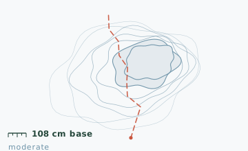
Mount Jo is 876 m, which makes it a foothill by High Peaks standards, and it still delivers more view per unit of effort than anything else in the region. The reason is position: it stands directly across from Algonquin and Wright, so the summit looks straight into the two biggest walls in the state. The route is short but genuinely steep in the middle, and the snow at the base stake is the deepest in this guide at 108 cm.
Arrival
From Lake Placid take Adirondack Loj Road south 13 km. The road is plowed to the lot but the surface is packed snow and ice for the final 4 km; the lot attendant collects a day-use fee in a booth that opens at 07:00. The snowshoe trail leaves from the north end of the lot, not from the main trailhead sign - the sign points to the Van Hoevenberg and Algonquin routes, which is the single most common error here.
The line
0.0-1.1 km · Old ski trail
The route climbs an abandoned ski run on a consistent 14-degree grade. Two downhill ski runs cross it at 0.6 km and 0.9 km - these are still used and a skier coming down has no way to stop or see you. Cross quickly and look uphill first.
1.1-2.6 km · The steep middle
This is the part people underestimate: 130 m of gain in 1.5 km, with three short 25-degree steps. Snow depth measured 108 cm at the 1.4 km stake on 3 February, of which the top 40 cm was loose and unconsolidated.
2.6-3.4 km · Ridge and summit outcrop
The grade eases onto a broad ridge, then the final 150 m is a rock outcrop that is usually wind-scoured to bare rock on top and holds a hard ice crust on the north approach.
3.4-4.6 km · Descent by the same route
There is no alternate descent. Coming down the steep middle is faster and more committing than going up - keep your heel lifters up and your weight back.
Travelling the line, step by step
- Find the north-end snowshoe entrance, not the main trailhead signWalk to the far end of the parking area away from the booth. The snowshoe trail starts there and is marked with a wooden sign; the main sign sends you toward Algonquin.
- Look uphill at both ski run crossingsAt 0.6 km and 0.9 km, stop, look up the run and listen before crossing. Downhill skiers cannot see or stop for you.
- Switch to microspikes for the summit outcropLeave your snowshoes clipped to your pack at the base of the rock. The top 150 m is usually bare rock with ice in the cracks.
- Turn around at the summit if the wind is upThe summit is small and fully exposed. If you cannot stand comfortably, take the photograph and go - there is nothing else up there worth the wind chill.
- Descend with heel risers engaged and weight backGet the risers up before you start down the steep middle, not halfway. Stopping on a 25-degree step to adjust bindings is how the falls happen.
What to carry
- Snowshoes with aggressive crampons and a heel riser - the steep middle is where both matter
- Two poles; the descent is hard on knees without them
- Microspikes for the summit outcrop, where snowshoes are worse than useless on bare rock
- Insulated bottle kept inside the pack, not in an outer pocket
- Balaclava or buff; the summit faces a gap between two 1,500 m peaks and the wind funnels
- Headlamp even for a morning start - this trail is used for rescues more than any other in the region
What can go wrong
- IceThe north approach to the summit outcrop carries a hard ice crust from December onward.
- AvalancheSmall but real: the 25-degree steps in the steep middle have slid on human triggers in high-load winters.
- Open waterA brook crosses at 0.4 km and stays open until mid-January.
This is a short route with real consequences on the descent: two of the three 25-degree steps end in trees, and a sliding fall in the wrong place is how most of the injuries happen. Carry microspikes for the summit even if you think you will not need them. The lot attendant logs parties leaving and expects you back by the closing time posted at the booth.
Before you go
- How does a 876 m foothill give the best view?
- Position, not height. Mount Jo sits 2.5 km east of Algonquin Peak with an unobstructed line of sight, so the whole 300 m of the Algonquin headwall is visible from the summit, plus the MacIntyre Range to the south-west.
- Is the day-use fee required in winter?
- Yes, the booth is staffed year round, 07:00 to 17:00. It covers parking and trail maintenance for the Loj property.
- Can I combine it with a bigger objective?
- People often link it to Wright Peak in a long day, but that adds 9 km and 700 m of gain and turns a 3-hour route into an 8-hour one. Do not do that on your first visit.
Nearby and similar
- Marcy Dam Truck Trail · Adirondack High Peaks · 9 km · Easy
- Follensby Clear Pond Loop · Adirondack High Peaks · 8.2 km · Easy
- St. Regis Portage Line · Adirondack High Peaks · 10.6 km · Moderate
The figures above are our own measurements from the date shown. Only the conditions on your day count: check the current forecast, the gate bulletin and the snowpack before you set out, and treat every ice crossing as open until you have tested it.