Forest road sector · Algonquin Park · ·
Moose Bog Access Road
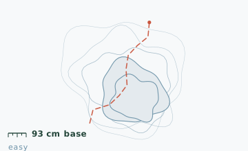
The Kingscote access road runs 9.6 km through lowland black spruce and open bog, and almost nobody walks it: the summer user is a canoeist heading for Kingscote Lake, and in winter there is no destination at the end except the lake itself, which is exactly the point. Snow depth measured 93 cm at the 4 km stake on 2 February, the second deepest in this guide, because nothing here is exposed enough to lose snow to wind.
Arrival
From Highway 60 take Highway 648 north 8 km, then the Kingscote Lake access road. The road is plowed to the 2.4 km gate and gated beyond. Register at the West Gate on Highway 60 before you go in - this is a requirement, not a formality, because the road has no winter maintenance and the gate is not monitored. The first 2.4 km is a plowed road; snowshoes go on at the gate.
The line
0.0-2.4 km · Plowed gate road
Walkable in boots. The plow turnaround at the gate holds six cars and is the last maintained point on the route. Snowshoes on from here.
2.4-5.0 km · Black spruce lowland
A straight road through dense black spruce with the bog on both sides. There is no view for 2.6 km and no side trail that goes anywhere. Snow depth at the 4 km stake measured 93 cm on 2 February, with a settled base of 61 cm under 32 cm of loose snow.
5.0-7.6 km · Bog crossings
Three sections where the road crosses open bog on corduroy - logs laid side by side and covered with fill. Under snow they are uneven and there are gaps. Two creek crossings at 5.4 km and 6.8 km have culverts that ice over and are the only places to be careful.
7.6-9.6 km · Final approach to the lake
The road climbs gently out of the bog and reaches the Kingscote Lake shoreline and a small clearing with a picnic table buried to its seat. The lake is the turnaround unless you are camping.
Travelling the line, step by step
- Register at the West Gate before driving to the trailheadGive your vehicle description, party size and turnaround time. The gate staff pass unclosed registrations to the park wardens the following morning.
- Probe the corduroy sections rather than trusting the surfaceFrom 5.0 km to 7.6 km the road crosses bog on laid logs with gaps between them. Probe each step; a leg through to the knee between logs is the standard injury here.
- Walk around the culvert crossings on the upstream sideBoth culverts ice on the surface. The upstream bank is shallower and usually frozen; the downstream side drops into open water.
- Turn around at the lake, not before, unless the weather is closingThe lake clearing is the only open view on the whole route and it is 300 m past the last corduroy. It is worth the extra 20 minutes.
What to carry
- Snowshoes from the gate onward - nothing past 2.4 km is packed
- Two poles for the corduroy sections, where the surface is uneven and full of gaps
- Insulated bottle and a full lunch; there is no shelter and no destination amenities
- Map; the road is straight but there are two unmarked spurs at 3.8 km and 6.1 km
- Headlamp - a 9.6 km out-and-back in deep snow is a full day for most parties
- Registered trip plan with the West Gate, plus a copy left at home
What can go wrong
- Open waterCulvert crossings at 5.4 km and 6.8 km ice over on the surface and hold open water underneath.
- IceThe corduroy sections have gaps between the logs that fill with snow and look solid.
- Open waterBeaver activity at 7.1 km floods the road edge in some years, and the ice there is thin over moving water.
This route is about as far from help as anything in this guide: 9.6 km in, no winter maintenance, no cell coverage past the gate, and the plowed turnaround is the only vehicle access. Register at the West Gate and be specific about your turnaround time. Two parties a winter get benighted on this road because a 9.6 km round trip in 93 cm of snow is four hours of steady work, not a walk.
Before you go
- Is there anywhere to camp at the end?
- Kingscote Lake has three backcountry campsites on the north shore, booked through Ontario Parks. In winter they are unmaintained but usable.
- Why is the snow deeper here than on the Highway 60 trails?
- The road runs through a lowland basin with spruce on both sides, so wind cannot reach the surface. The Highway 60 corridor trails are on higher, more open ground and lose snow to wind packing.
- Do I really need to register?
- Yes. The gate is not monitored, the road is not maintained, and the registration is what triggers a search if you do not come out. It takes two minutes at the West Gate.
Nearby and similar
- Mizzy Lake Boardwalk Line · Algonquin Park · 10.8 km · Moderate
- Track and Tower Trail Line · Algonquin Park · 7.7 km · Challenging
- St. Regis Portage Line · Adirondack High Peaks · 10.6 km · Moderate
The figures above are our own measurements from the date shown. Only the conditions on your day count: check the current forecast, the gate bulletin and the snowpack before you set out, and treat every ice crossing as open until you have tested it.