Forest road sector · Laurentides · ·
P'tit Train du Nord Northbound Corridor
The railbed corridor is the least dramatic and most useful route in the Laurentides: 12.4 km of former Canadian Pacific right-of-way, never steeper than 2 percent, running through the back of six villages. It is where you go to test new gear, to take someone out for the first time, or to get a long distance in on a day when the ridges are being scoured. The downside is that it is popular, and after a weekend the track is packed hard enough that snowshoes are optional for the first 4 km.
Arrival
Both end lots are plowed and signposted from the village main streets. The railbed itself is shared with fat bikes north of kilometre 6, and the two user groups have separate packed lanes only where the corridor is wider than 8 m, which is about 60 percent of the route. Bridge decks at 3.2 km and 9.1 km are planked and stay bare.
The line
0.0-4.0 km · Village backlots
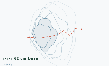
The corridor runs behind gardens and through a rock cut at 2.6 km. The cut is the only place on the route where wind enters, and it is where the snow is deepest - measured 62 cm at the 2.8 km stake on 22 January against 41 cm at the 0.5 km stake.
4.0-8.0 km · Lake shore and the long straight
A 1.4 km stretch runs within 15 m of the lake edge. The ice is crossable by mid-January most years, but the railbed is faster and the shore ice near the outlet at 5.6 km stays thin.
8.0-12.4 km · Climbing to the north terminus
The grade lifts slightly to a consistent 1.8 percent and the forest changes from mixed hardwood to spruce. The last 900 m into Sainte-Agathe is through a residential street.
Travelling the line, step by step
- Decide up front whether you are doing one-way or out-and-backOne-way needs two cars or the weekend shuttle. Out-and-back to the lake section is 9 km and covers the two best stretches, which is what most people should do.
- Keep right on the two bridge decksFat bikes come through the plank decks fast and cannot stop on ice. Step off the deck if you need to look at anything.
- Use the 6.8 km shelter for your only long stopIt has a wood stove that the village maintains, three walls, and a log bench. It is the only structure on the route open to the public.
- Watch the grade change at 8 kmThe climb to Sainte-Agathe is gentle but relentless. If you are tiring, turn at the 8 km marker rather than pushing to the terminus and walking back in the dark.
What to carry
- Snowshoes for the first 4 km; after that a light pair is still worth carrying for the cut section
- One pole is plenty - the grade never demands more
- A headlamp if you are doing the full one-way; the north 4 km has no lighting
- Small stove or thermos for a stop at the 6.8 km shelter
- Reflective item on your pack for the two bridge decks where fat bikes come through fast
- Cash or card for the village bakery at the 7.4 km road crossing
What can go wrong
- IceTwo bridge decks and the rock cut at 2.6 km ice over in freezing drizzle and stay glazed for days.
- Open waterShore ice near the 5.6 km lake outlet is unreliable even in February.
The corridor is 3-6 km from the nearest road at every point, but it is also within cell coverage for its entire length, and both terminus villages have year-round services. The real hazards are the shared use with fat bikes on blind bridge decks and the rock cut, and the fact that people underestimate a 12.4 km round trip in deep snow - four hours is realistic, not two.
Before you go
- Do I need a trail pass?
- No. The corridor is a linear park and is free year round. Some sections charge for parking in summer only.
- Is it suitable for a first snowshoe trip?
- It is the best route in this guide for that purpose. The grade is constant, the track is usually broken, and you are never more than 3 km from a village.
- How much of it can I ski?
- All of it, and the corridor is groomed for classic skiing on the 6 km between Val-David and the lake section on alternating days. Snowshoers are asked to stay off the groomed lane.
Nearby and similar
- Frost Hollow Traverse · Laurentides · 7.8 km · Moderate
- Le Centennial Ridge Route · Laurentides · 9.6 km · Challenging
- Mont Condor Lookout Route · Laurentides · 6.2 km · Moderate
The figures above are our own measurements from the date shown. Only the conditions on your day count: check the current forecast, the gate bulletin and the snowpack before you set out, and treat every ice crossing as open until you have tested it.