Mountain sector · Adirondack High Peaks · ·
Marcy Dam Truck Trail
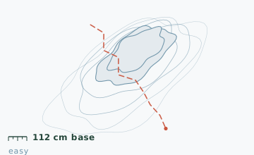
The truck trail was built to haul materials to Marcy Dam and it shows: a constant, gentle grade with no switchbacks and no pitch over 12 degrees. It is 2.2 km shorter to the dam than the hiking trail and it holds the deepest measured base in the region at 112 cm. The trade-off is that it crosses three drainages on bridges that are not maintained in winter, and it passes through a stretch of blowdown from a 2019 wind event that has never been fully cleared.
Arrival
From the Loj lot, walk past the outbuildings to the south-east and pick up the gated truck road. The gate is open in winter for foot traffic only. The first 400 m is shared with a ski trail, then the truck road splits right at a sign and the ski trail continues left. Snowmobiles are not permitted on this route at any time of year.
The line
0.0-2.6 km · Lower grade
Constant 5-degree climb through hardwood. The blowdown section runs from 1.4 km to 2.2 km on the left side of the road; it is passable but the edge is undermined, so stay in the centre of the tread.
2.6-5.4 km · Bridge crossings
Three bridge crossings at 2.9 km, 3.8 km and 4.7 km. All three decks are open timber with no railing on the downstream side. Snow depth at the 3 km stake measured 112 cm on 8 February, with 45 cm of that loose on top of a settled base.
5.4-7.0 km · Final approach to the dam
The road flattens and runs directly at the dam. Marcy Dam itself was rebuilt in timber after 2011 flood damage and the structure now sits 2 m lower; the view up the valley to Mount Colden is unchanged.
7.0-9.0 km · Return by the same road
There is no loop option. Coming back is faster because the grade runs with you, and most parties do the whole 9 km in under three hours on the return leg.
Travelling the line, step by step
- Find the truck road behind the outbuildingsFrom the Loj lot, walk to the south-east corner past the storage sheds. The gated road is 60 m behind them and is signed. Going out via the main trailhead adds 2.2 km for no benefit.
- Keep to the centre of the tread through the blowdownFrom 1.4 km to 2.2 km the left edge of the road is undermined by root holes. The centre is solid; the edge is not.
- Cross each bridge deck without stoppingUnrailed decks and slick timber. Cross one at a time, keep a hand free, and do not stop to take pictures from the middle.
- Treat the dam as your turnaround unless you are equipped for the summitPast the dam the terrain changes completely: the grade steepens to 20 degrees and the route becomes a winter mountaineering objective. Snowshoes alone are not the right kit beyond that point.
What to carry
- Snowshoes - the base is deep and the road is wide enough for a proper track
- One pole for the three bridge decks, which are the only technical bit
- Headlamp; the blowdown section is dark in the afternoon even on a clear day
- Insulated bottle plus food - the dam is a natural lunch stop
- Camera; the Colden view from the dam is the single best effort-to-view ratio in the High Peaks
- Crampons or microspikes in case a January thaw glazes the road, which it does about one year in three
What can go wrong
- Open waterThe three bridge decks are unrailed on the downstream side and the planking is not maintained in winter.
- IceThe road glazes during January thaws; the shaded section between 1.4 and 2.2 km is the worst.
The gradient is gentle and the route is short, so this is a good winter objective for a fit beginner. Two things to respect: the unrailed bridge decks and the blowdown edge, both of which have put people into the water or off the tread. There is no cell coverage past the 2 km mark, and the dam area is a designated camping zone, so there will usually be other people there in an emergency.
Before you go
- Is the truck trail shorter than the hiking trail?
- To Marcy Dam, yes - 4.5 km against 5.6 km on the Van Hoevenberg trail. The truck trail is the one locals use in winter for exactly that reason.
- Can I continue past the dam?
- Yes, the truck trail ends there but the Van Hoevenberg trail continues to the Marcy summit. That is a full winter mountaineering day, not a snowshoe walk.
- Why is the snow so deep here?
- It is a low, narrow valley that runs north-east to south-west with a broad opening at the dam end. Lake-effect moisture from the west deposits heavily and the valley walls keep the wind out, so what falls stays.
Nearby and similar
- Mount Jo Short Ascent · Adirondack High Peaks · 4.6 km · Moderate
- Follensby Clear Pond Loop · Adirondack High Peaks · 8.2 km · Easy
- St. Regis Portage Line · Adirondack High Peaks · 10.6 km · Moderate
The figures above are our own measurements from the date shown. Only the conditions on your day count: check the current forecast, the gate bulletin and the snowpack before you set out, and treat every ice crossing as open until you have tested it.