Forest road sector · Adirondack High Peaks · ·
Follensby Clear Pond Loop
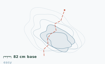
This loop is the textbook Adirondack lowland route: five ponds, two carry trails, and a snowpack that never gets steep enough to slide. What it lacks in drama it makes up for in consistency - the base stake at the 2 km mark read 82 cm on 6 February and 84 cm on 6 March, a variation of 2 cm across a whole month, which is unusual anywhere.
Arrival
Route 30 north from Fish Creek, 9.4 km to the plowed pull-off on the left. The descent to the first pond from the road is short and steep - about 12 m at 20 degrees - and is the only real hill on the whole loop. Ice thickness on Follensby Clear Pond should be checked at the access point with an auger or a chisel; the pond has springs and the west bay can be 20 cm thinner than the main body.
The line
0.0-2.0 km · Follensby Clear Pond shoreline
The route follows the north shore on a well-used snowmobile trail for 1.4 km, then turns onto the marked snowshoe route at a junction sign. Ice thickness at the north access measured 38 cm on 20 January, which is above the 25 cm threshold considered safe for a group on foot.
2.0-4.6 km · Carry trail to Horseshoe Pond
A 400 m woodland carry that climbs 18 m and drops back. This is where the loop stops feeling like a road walk. The trail here is narrow and single-file; two parties meeting need to step into the snow.
4.6-6.8 km · Horseshoe and Little Square ponds
Two smaller ponds joined by a 90 m channel that is often the last thing to freeze in the area. Cross the channel on the marked portage, not on the ice, unless you have personally tested it that day.
6.8-8.2 km · Return through the flats
A flat run through mixed wetland and spruce on a former logging road. The last 300 m back to the pull-off is the steep 20-degree bank you came down at the start.
Travelling the line, step by step
- Measure the ice before you leave the access pointChip or drill 10 m out from the shore at the access and read the thickness. If it is under 15 cm, keep the whole loop on the carry trails and shoreline.
- Follow the junction sign at 1.4 km, not the snowmobile trackThe snowmobile trail continues north to a dead end used by ice anglers. The snowshoe route turns east and is signed with a yellow disc.
- Walk the marked portage between Horseshoe and Little SquareThe 90 m channel to the east of the portage is the last water to freeze and the first to open. It is not worth 90 m of shortcut.
- Save energy for the bank at the endThe 20-degree climb back to Route 30 comes after 8 km and is steeper than anything else on the loop. Do not spend everything on the return flat.
What to carry
- Snowshoes - the carry sections are narrow and post-holing wrecks them
- Ice chisel or auger if you intend to walk any pond surface
- One pole; the loop is flat but the shoreline is uneven
- Warm layer for the two long shoreline stretches, which are fully exposed to the west wind
- Map with carry trails marked - this area has more unmarked logging spurs than marked routes
- Small thermos; the loop has no shelter of any kind
What can go wrong
- IceFollensby Clear Pond has springs; the west bay measured 20 cm thinner than the main body in January.
- Open waterThe 90 m channel between Horseshoe and Little Square ponds is the last water in the area to freeze.
- IceThe 20-degree bank at the start becomes a luge run after rain; a slip here puts you in the pond.
This is the safest route in the guide and the only one where a solo snowshoer with experience is reasonable. The single rule that matters is ice: never walk past the marked portage onto a channel, and never trust a pond surface you have not measured that day. Cell coverage is good along Route 30 but drops in the carry sections.
Before you go
- Do I need a permit?
- No. The area is part of the Saranac Lakes Wild Forest and day use requires no permit or fee. Camping would, but that is a summer question here.
- How thick does ice need to be?
- The commonly used figure for a group on foot is 10 cm of clear black ice. The 38 cm measured at the north access is well past that, but springs make local exceptions.
- Can I do this loop on cross-country skis?
- The shoreline stretches are fine. The two carry sections involve tight turns through trees and are much better on snowshoes.
Nearby and similar
- St. Regis Portage Line · Adirondack High Peaks · 10.6 km · Moderate
- Marcy Dam Truck Trail · Adirondack High Peaks · 9 km · Easy
- Mount Jo Short Ascent · Adirondack High Peaks · 4.6 km · Moderate
The figures above are our own measurements from the date shown. Only the conditions on your day count: check the current forecast, the gate bulletin and the snowpack before you set out, and treat every ice crossing as open until you have tested it.