Park sector · Gatineau Park · ·
Luskville Falls Ascent
This is the shortest and steepest route in this guide: 290 m of gain in 2.1 km, on rock steps cut by the park service into the Eardley escarpment. There is no snowshoe track for the middle third - you are on bare, iced rock with a fixed chain handrail for about 90 m. It is included because it is the only place in the Gatineau where a snowshoer can get genuinely exposed terrain within half an hour of a city, and because the failure mode here is a fall, not an avalanche.
Arrival
Highway 148 north-west from Ottawa to the Luskville Falls sign, then 300 m up the access road to P13. The first 1.1 km is a wide, gently climbing trail with two switchbacks. At 1.1 km the route reaches the base of the falls and the character changes completely: from there it is rock steps, chains and, in a normal winter, a 10-15 cm layer of ice on every tread.
The line
0.0-1.1 km · Lower trail
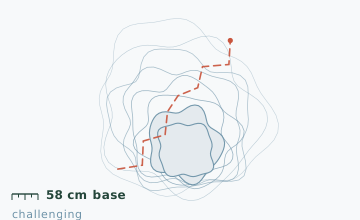
Wide, 10-degree grade, two switchbacks. Snowshoes are pointless here; most people carry them. Snow depth at the 0.8 km stake measured 58 cm on 19 January, which is the shallowest base in this guide.
1.1-2.1 km · Rock steps and chains
About 40 steps of cut rock with a fixed chain on the uphill side and a 90 m section where the chain is essential. The treads are iced from late December. Do not use snowshoes here: the frames do not sit on the steps and the crampons skate on the ice.
2.1-3.1 km · Ridge and lookout
Above the steps the route reaches the escarpment top at 290 m and follows a broad, wooded ridge to a lookout over the Ottawa River. This part is snowshoe terrain again and is the reward for the climb.
3.1-4.2 km · Descent by the same line
There is only one descent. Going down the iced steps is significantly harder than going up, and it is where the park's rescue calls originate.
Travelling the line, step by step
- Put crampons on at the falls base, not at the first icy stepThere is a flat area at 1.1 km where you can sit down. Fitting crampons while standing on an iced step is how people fall before they start.
- Take the chain with your uphill hand onlyKeep one pole in the downhill hand for balance. Both hands on the chain means no balance if a foothold fails.
- Climb the steps on the outside edge of the treadCut steps drain to the inside corner, which is where the ice is thickest. The outer 10 cm of each tread usually has better grip.
- Decide about the descent before you start upIf the chain section is glazed all the way through, the descent will be worse. Look at it from the bottom on the way up and make the call there.
What to carry
- Full crampons or aggressive microspikes for the rock steps - this is the one route in the guide where they are mandatory, not optional
- Snowshoes carried, used only above the ridge at 2.1 km
- Two poles, but stow one for the chain section so one hand is always free
- Gloves with grip; bare-handing a frozen chain at -15 C is a 30-second limit
- Headlamp
- Warm layer for the ridge lookout, which is fully exposed to the north-west wind
What can go wrong
- IceThe 40 rock steps are glazed from late December to mid-March, and the 90 m chain section is the single highest-consequence 90 m in this guide.
- Open waterThe falls themselves spray and freeze on the steps immediately beside the route in cold, windy conditions.
This is a fall-hazard route, not an avalanche route, and the mitigation is different: crampons, one free hand, and turning around if the chain section looks glazed all the way through. Do not take children or dogs onto the chain section. Two people have been seriously injured here in the last five winters, both on descent. Cell coverage is good throughout because of the proximity to Ottawa.
Before you go
- Can I do this in snowshoes alone?
- No. The 40 rock steps are iced and the snowshoe frame does not sit flat on a step. You need crampons for the middle third and snowshoes only for the ridge above.
- Is the falls frozen enough to climb?
- That is ice climbing, not snowshoeing, and the park restricts it. The route described here goes beside the falls, not on them.
- How long does 4.2 km really take?
- Three and a half hours for a fit party. The distance is misleading: half of it is on rock at 20-plus degrees, and the descent is slower than the climb.
Nearby and similar
- Luskville Ridge Loop · Gatineau Park · 6.8 km · Moderate
- La Peche Ridge Link · Gatineau Park · 7.2 km · Moderate
- La Peche Lake Circuit · Gatineau Park · 9.4 km · Easy
The figures above are our own measurements from the date shown. Only the conditions on your day count: check the current forecast, the gate bulletin and the snowpack before you set out, and treat every ice crossing as open until you have tested it.