Forest road sector · White Mountains · ·
Bear Notch West Side Road
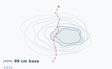
Bear Notch Road is plowed in summer and gated in winter, which turns 11.2 km of forest road into an unbroken snowshoe line with 89 cm of base and about a third of the traffic of the Kancamagus corridor. The route described here runs the west half, north to south, and finishes on the Sawyer River Road. It is the best low-commitment deep-snow route in this guide and the easiest place to have a genuinely quiet day within an hour of North Conway.
Arrival
From the Kancamagus Highway take Bear Notch Road north; the gate is 7.2 km up and is where the plowing stops. From the gate the route is the road itself for the first 6 km; the road bed is graded and drains well, so it is rarely slushy even after a thaw. The Kancamagus end has no winter parking, so plan a two-car shuttle or an out-and-back.
The line
0.0-3.4 km · Gated road, climbing
A steady 3-5 degree grade through northern hardwood. There are two unmarked logging spurs on the left at 1.8 km and 2.9 km; both dead-end within 600 m and both look like the main road in flat light.
3.4-6.4 km · The notch itself
The road tops out at 415 m and passes through a shallow gap between two ridges. This is the only place with wind exposure and the only place where the base drops below 60 cm because of scouring. Snow depth at the 5.1 km stake measured 89 cm on 14 February.
6.4-9.0 km · Descent to the Sawyer River
A gentle descent toward the Sawyer River valley, with the forest changing from hardwood to spruce and fir. Two clear cuts on the right at 7.8 km are good viewpoints back at the notch.
9.0-11.2 km · Sawyer River Road
The route joins the Sawyer River Road and follows it south. The final 1.2 km has three houses on the left that are occupied year round; keep to the road and do not cut across the fields.
Travelling the line, step by step
- Walk from the gate, not from the plowed end of the roadThere is no winter parking below the gate on the Kancamagus side, and the road shoulder there is a snowmobile corridor.
- Note the two spur junctions on your way inAt 1.8 km and 2.9 km, turn and look back. The spurs are obvious from this direction and nearly invisible on the return in flat light.
- Eat before the notch, not in itThe 3.4-6.4 km section is the only exposed part of the route. Stop at 3.2 km in the last of the trees instead.
- Keep to the road past the houses at 10 kmThree year-round homes sit on the left at the end of the route with fields in front. The road is the right-of-way; the fields are not.
What to carry
- Snowshoes; the road is wide and a broken track makes the whole 11.2 km comfortable
- One pole - there is no technical terrain
- Insulated bottle and a real lunch; there is no shelter and no water source that stays open high on the route
- Paper map; the two logging spurs look like the main road in flat light and there is no cell coverage in the notch
- Warm layer for the 3.4-6.4 km exposed section
- Ski poles with large baskets if the snow is fresh, so you do not post-hole to your knee with every step
What can go wrong
- Open waterThe Sawyer River tributary at 9.4 km crosses under a culvert that ices over and can be stepped around only on the upstream side.
- IceThe notch section glazes after a thaw-and-refreeze, and the road has a side slope there.
Nothing here is technical. The two risks are navigation and cold: the logging spurs are convincing in flat light, and the notch is the only place where you lose the wind shelter. Cell coverage is reliable on the first 3 km and absent from 3.4 to 8 km, so make your decisions before you enter the notch. The gate is not locked for foot traffic, but the Forest Service does close the road entirely during a major storm.
Before you go
- Can I drive to the gate in winter?
- Only from the Kancamagus side and only as far as the plowing goes, which is the gate itself. The Sawyer River end is not plowed at all.
- Are snowmobiles allowed?
- The corridor is a designated snowmobile route in some years, but the western half is usually left ungroomed for skiing and snowshoeing. Check at the Kancamagus ranger station.
- Is 11.2 km too far for a first trip?
- Do the out-and-back to the notch at 6.4 km instead, which is 12.8 km total but on a better surface, and gives you the two best sections.
Nearby and similar
- Tuckerman Ravine Base Line · White Mountains · 7.6 km · Challenging
- Lost Pond Trail · White Mountains · 3.4 km · Moderate
- Mizzy Lake Boardwalk Line · Algonquin Park · 10.8 km · Moderate
The figures above are our own measurements from the date shown. Only the conditions on your day count: check the current forecast, the gate bulletin and the snowpack before you set out, and treat every ice crossing as open until you have tested it.