Park sector · Gatineau Park · ·
La Peche Lake Circuit
Four lakes, three short portages, and a total of 110 m of elevation across 9.4 km: this is the flattest route in the guide and the one where the ice, not the terrain, is the whole story. Gatineau Park's northern lakes are shallow and spring-fed, which means they freeze later and less evenly than the bigger lakes further south, and the park's own ice-safety advisory is worth reading before you go.
Arrival
From Highway 148 take Chemin de la Riviere-aux-Sables north 14 km. The road is gravel from 8 km and the last 2 km has two hills that are plowed but not sanded. The circuit starts at the boat launch at the south end of the first lake; the portages are marked with blue discs and are maintained by the park in winter.
The line
0.0-2.8 km · First lake crossing
A 2.8 km crossing on ice to the north end of the first lake. Ice measured 41 cm on 16 January, which is plenty for a group on foot. Two summer cottages on the east shore are closed; do not use their docks as access points.
2.8-4.1 km · First portage
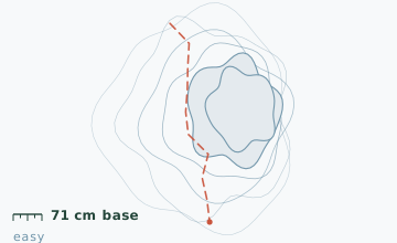
A 320 m carry climbing 22 m through mixed forest to the second lake. This is the only climb on the circuit that makes you breathe. Snow depth at the 3.4 km stake measured 71 cm on 16 January.
4.1-6.9 km · Second and third lakes
Two crossings separated by a 140 m carry. The channel between them is narrow and has current, and it is the one place on this circuit where the ice is not reliable in January. Take the marked portage.
6.9-9.4 km · Fourth lake and return
The last crossing is 1.7 km and is followed by a 700 m carry back to the first lake's south end. From there it is a short walk to the boat launch.
Travelling the line, step by step
- Test the ice 10 m out at every single crossingChip a hole, read the thickness, and write the four numbers down. Conditions differ by lake because the inlets and springs differ.
- Cross the second-to-third lake channel by the portageThe blue disc marks the take-out. The channel itself is 140 m of moving water under a thin shell, and it is the one piece of ice on this circuit that should never be trusted.
- Keep off the cottage docks on the first lakeBoth east-shore properties are closed in winter and the park asks that the shoreline in front of them stays clear so the owners can inspect for ice damage.
- Do the loop clockwise to put the long carry lastClockwise puts the 700 m carry at the end when you are on flat ground again, rather than the 320 m climb at the end when you are tired.
What to carry
- Snowshoes for the three carries; the lake surfaces are usually wind-packed and faster in boots
- Ice chisel or a drill with a 100 mm bit for testing at each crossing
- One pole
- A throw line if you are leading a group of more than four
- Insulated bottle; nothing on this circuit is sheltered enough to stop for long
- Map showing the portages - the blue discs are the only markers, and two of them are on posts that get buried
What can go wrong
- IceThe channel between the second and third lakes has current and is unreliable throughout January.
- IceThe two inlets on the north shore of the first lake stay open in a mild winter and are not visible as dark patches under fresh snow.
Ice is the only real hazard and it is manageable with a chisel and a rule: measure at every crossing regardless of what you measured the last time, and turn around if it is under 15 cm. The park posts ice conditions at the P17 gate from January. Do not walk the circuit alone; a self-rescue from open water in this lake chain is not realistic in winter clothing.
Before you go
- Is the park's winter camping open here?
- The La Peche area has four winter campsites on the third lake, booked through the park's reservation system. They have a wood stove and a raised floor.
- Can I skate the crossings?
- On the first lake in a clear January, yes, and people do. The other three lakes have snow cover all winter and are not skateable.
- Why is the base shallower here than in the mountains?
- It is 200 m lower and sits in the Ottawa valley's rain shadow. The 71 cm figure is a mid-January reading and the deepest it usually gets is about 85 cm in early March.
Nearby and similar
- La Peche Ridge Link · Gatineau Park · 7.2 km · Moderate
- Luskville Ridge Loop · Gatineau Park · 6.8 km · Moderate
- Luskville Falls Ascent · Gatineau Park · 4.2 km · Challenging
The figures above are our own measurements from the date shown. Only the conditions on your day count: check the current forecast, the gate bulletin and the snowpack before you set out, and treat every ice crossing as open until you have tested it.