Mountain sector · White Mountains · ·
Tuckerman Ravine Base Line
This route goes to the floor of Tuckerman Ravine and stops there. That distinction matters: the ravine floor sits at 1,150 m beneath a 550 m headwall that produces the most studied avalanche cycle in the eastern United States, and the line to the floor crosses the bottom of the runout in its last 400 m. The reward is a view into a glacial cirque that looks nothing like the rest of New England, and the deepest measured snow in the White Mountains at 132 cm.
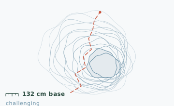
Arrival
Route 16 to Pinkham Notch. The trail climbs from the lot on the Tuckerman Ravine Trail, crossing the Cutler River at 0.9 km on a bridge that is the only maintained crossing. At 3.1 km the route reaches Hermit Lake Shelters, which is staffed by a caretaker in winter and posts the day's avalanche forecast. Past Hermit Lake the route continues 700 m to the ravine floor and the line described here ends at the first big boulder field.
The line
0.0-3.1 km · Hermit Lake climb
A steady 12-16 degree climb on a wide, well-broken trail. Snow depth at the 2 km stake measured 132 cm on 29 January; the trail surface is usually packed to a 30 cm width and post-holing beside it is knee-deep. Two shortcuts on the right at 1.4 km and 2.3 km are steeper and save nothing.
3.1-3.8 km · Hermit Lake to the ravine mouth
The trail flattens across a bench, passes the caretaker cabin and the toilets, then enters the ravine mouth. This is the last sheltered point. From here the terrain becomes a series of frozen boulder steps with 40-70 cm of snow on top of them.
3.8-5.4 km · Ravine floor approach
The route climbs over the boulder field on a marked line of cairns that are buried in most winters. Underneath is a snow-covered talus slope of 18-22 degrees - this is the section that lies in the runout path.
5.4-7.6 km · Turnaround and descent
The turnaround point is the flat floor of the ravine at the base of the headwall, roughly 400 m past the last cairn. Descent is on the same line and takes about 40 percent less time, but the boulder steps are worse going down.
Travelling the line, step by step
- Read the forecast at Hermit Lake before going past the cabinThe caretaker posts the day's rating on the cabin wall by 08:00. If the rating above the ravine floor is considerable or higher on any aspect, the last cairn is your turnaround.
- Switch to crampons for the boulder stepsBetween the ravine mouth and the floor there are roughly eight sections of frozen boulder. Snowshoes are worse than crampons on all of them, and the switch costs two minutes.
- Spread out to 20 m on the runout crossingOnce you enter the boulder field, no two people walk side by side. The exposure is short but it is the whole reason this route has rules.
- Set a hard turnaround of 13:30 at the cabinFrom Hermit Lake the floor is about 90 minutes for a fit party. Turning at 13:30 at the cabin leaves daylight for the 3.1 km descent.
What to carry
- Snowshoes with crampons, plus microspikes or full crampons for the boulder steps - you will switch at least twice
- Ice axe if there is any chance you will continue past the last cairn; a pole is not a substitute above the ravine floor
- Avalanche transceiver, probe and shovel, carried by every member of the party, not shared
- Goggles and a full face cover; the ravine mouth funnels wind at all times
- Insulated bottle and 2,000 calories minimum - this is a 5.5 hour day in the cold
- Headlamp plus spare batteries; a slow party is a dark descent here
- Repair kit; a broken binding at Hermit Lake is a 3 km problem
What can go wrong
- AvalancheThe last 400 m to the ravine floor crosses the bottom of the runout path from the headwall. It is the reason this route has a seasonal cut-off.
- IceThe boulder steps between the ravine mouth and the floor are glazed under the snow and are where most falls happen.
- Open waterThe Cutler River crossing at 0.9 km is the only maintained bridge; the river is not crossable elsewhere in winter.
Do not do this route without reading the day's avalanche forecast at Hermit Lake, and do not go past the last cairn if the rating is considerable or higher on any aspect above the ravine floor. A party of three with transceivers who have practised a beacon search is the minimum standard for the upper section. The caretaker at Hermit Lake logs parties and will ask what you are doing; answer honestly, because that log is what the rescue team uses.
Before you go
- Is this the route people ski the headwall from?
- It starts the same way, but the skiing happens on the 55-degree headwall itself, which is a different discipline with a different season. The line described here stops at the floor and is a snowshoe route.
- How deep is the snow at the ravine floor?
- The 132 cm figure is the stake at 2 km, not the floor. On the floor itself, wind loading and scouring make the depth vary from 40 cm on the exposed ribs to well over 3 m in the lee of the headwall.
- What is the latest in the season this is reasonable?
- Late February in an average year. After that the runout risk rises faster than the snowpack settles, and the floor becomes a place to look at rather than stand on.
Nearby and similar
- Lost Pond Trail · White Mountains · 3.4 km · Moderate
- Bear Notch West Side Road · White Mountains · 11.2 km · Easy
- Track and Tower Trail Line · Algonquin Park · 7.7 km · Challenging
The figures above are our own measurements from the date shown. Only the conditions on your day count: check the current forecast, the gate bulletin and the snowpack before you set out, and treat every ice crossing as open until you have tested it.